|


| |
Hiking the Iron Goat Trail
Sunday, July 2, 2006
by Lindsay Korst
gngoat@gngoat.org
The Iron Goat trail follows the route of the former
Great Northern Railway line from Scenic to Wellington
and the original 2.63 mile long Cascade Tunnel in the
Washington Cascades. For more information on this trail,
check out its official website:
http://www.irongoat.org/
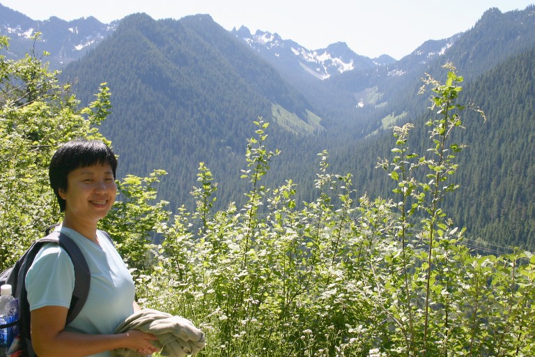
Baolu and I had always wanted to hike the entire length
of the Iron Goat trail, at least on the upper level.
The section from Wellington trailhead to the Windy
Point tunnel is especially scenic amongst the old
concrete snowsheds with views of the valley below.
We were up very early Sunday (5am!) and out the door
by six with a quick stop at Monroe for gas and
provisions (things to eat). The next stop was the
Sultan bakery with their enormous and delicious
breakfasts. Their bakery items are legendary too.
Lindsay says check it out:
http://www.mrbreakfast.com/r_display.asp?restid=4543
Appetites satisfied, we headed off to the Old
Cascade Highway turnoff, just past Skykomish on
US 2. Both Baolu and I were driving our own
vehicles and were keeping in touch with our little
two-way radios. The idea was we would position
a car/truck at each end of the trail and head
DOWNHILL! (now that's my kind of hike...)
At milepost 55, we turned off US 2 onto the
Old Cascades highway which wound its way
through a dense, second-growth forest. Baolu
said the twisty road was like "driving in
a TV commercial". Next, we turned onto
a gravel forest service road and headed up
to the Martin Creek trailhead. It was early
and there were no cars in the parking lot.
We left my truck at Martin Creek and got
in Baolu's car, rejoining the old highway
and following it up to Scenic where we met
US 2. From here, we drove up to the top of
Stevens Pass and turned left onto the highway
which switchbacked its way down to the
Wellington Trailhead. Again, we were the
first car in the parking lot.
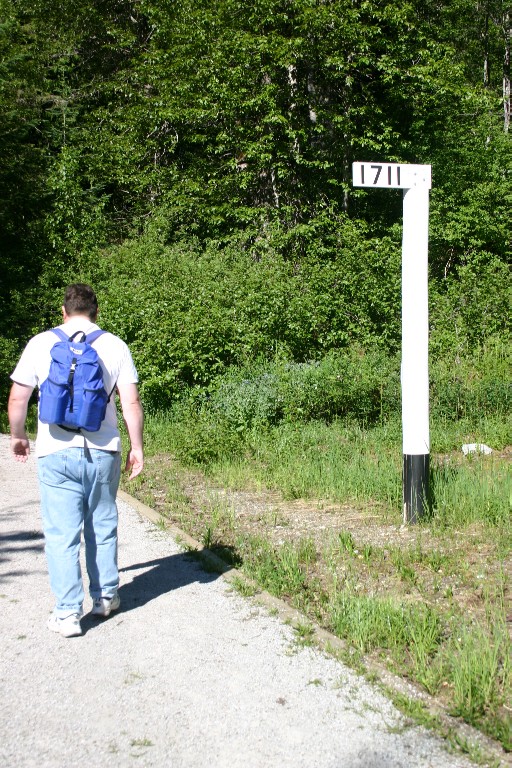
We started off westbound quickly passing the
1711 milepost (GN railway miles from Saint
Paul, Minnesota).
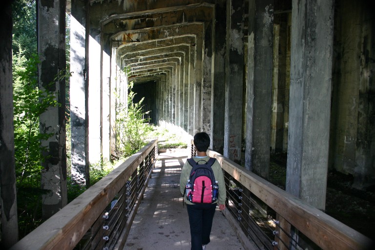
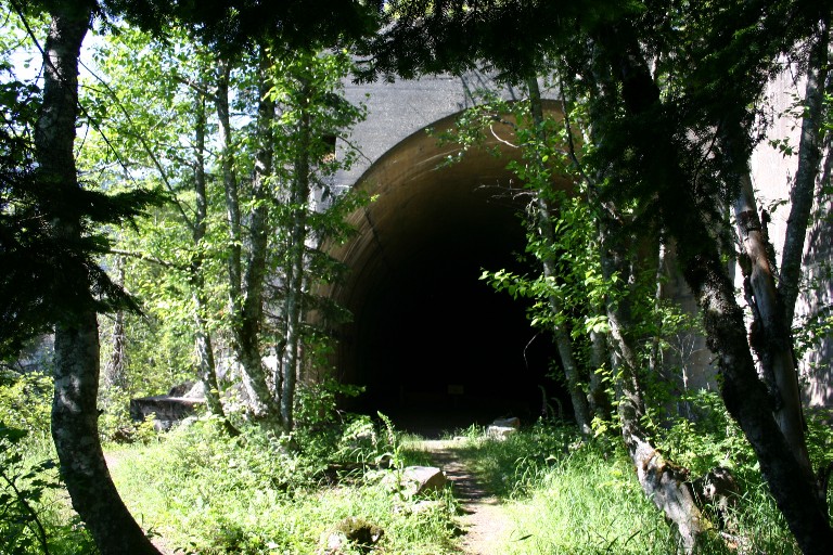
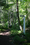
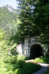
In no time at all, we were inside the double-track
concrete snowsheds and hoofing our way along.
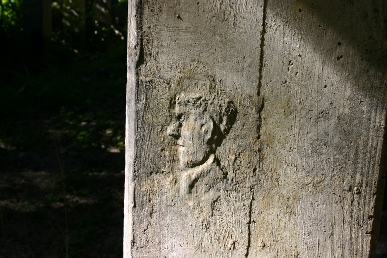
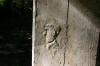
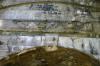
Saw this interesting image built right into one of
the snowshed pillars. Who could it be? A concrete
mason who built the sheds?
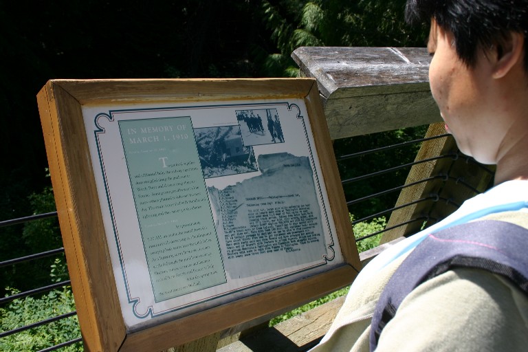
At one point, there was a side trail which took us
out to where the Wellington avalanche occurred
on March 1, 1910. A solemn moment.
If you'd like more information on the Wellington
Avalanche or area, please visit Bob Kelly's
website at:
http://home1.gte.net/mvmmvm/index.html
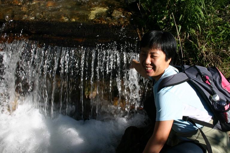
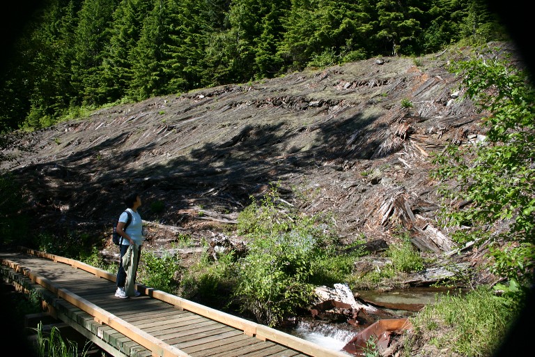
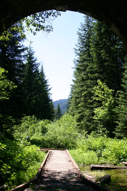
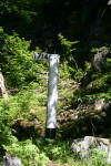
Eventually, the concrete snowsheds end and
we found ourselves in forest crossing several
streams. Oh, that water (melted snow) is COLD!

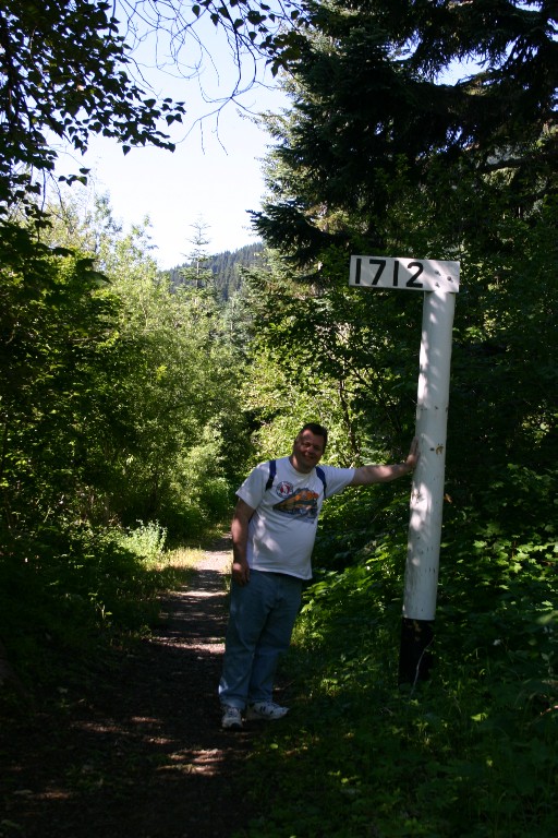
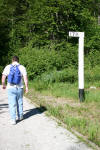
Here I am holding up the 1712 milepost marker.

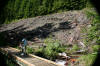
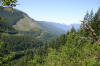
Here we broke out of the woods and got a good view
of a wooden snowshed completely flattened and slowly
returning to nature.
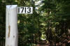
Milepost 1713, just shy of the Windy Point tunnel is
in lush forest.
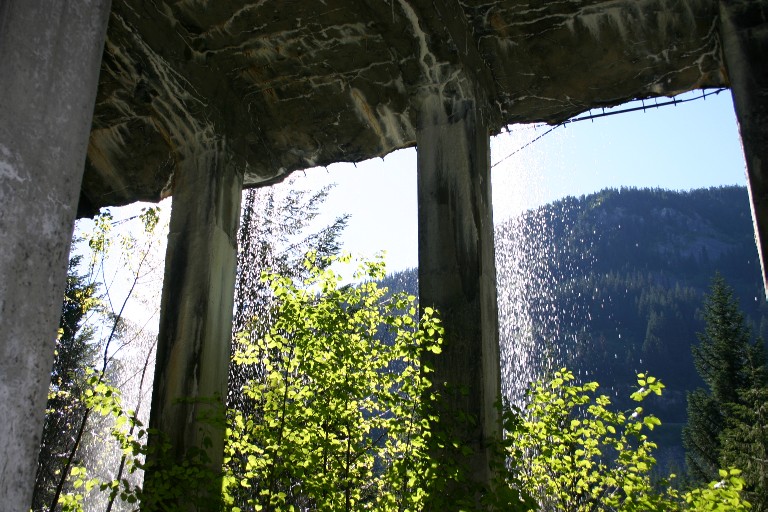
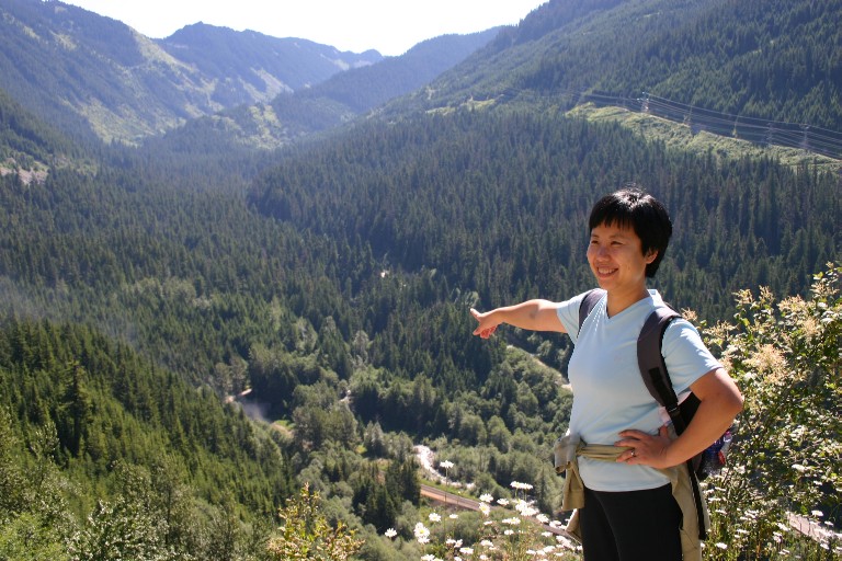
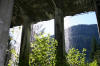
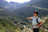
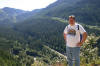
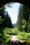
At Windy Point overlook, you can see Scenic, Washington
far below with both the BNSF mainline and US 2 visible.
The railroad gods obliged us with a westbound train
coming out of the west portal of the new Cascade Tunnel
(7.8 miles long).
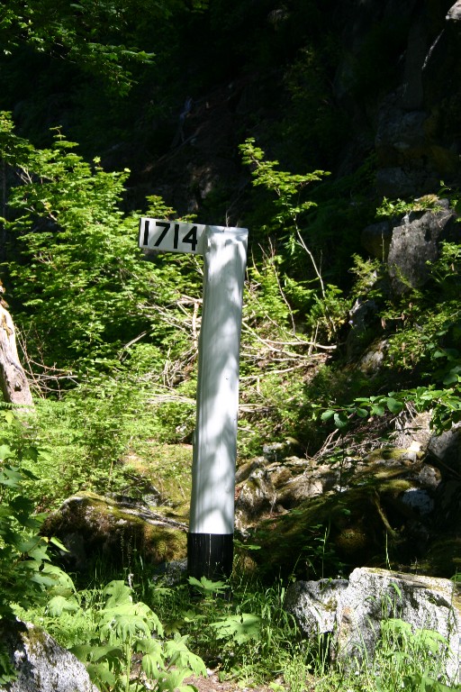
Milepost 1714 was just around the other side of the
Windy Point Tunnel. To get there, you must walk a few yards
along this very narrow edge of the concrete snowshed.
Don't look down! No picture of it. I was
concentrating on walking.
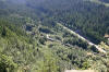
There were lots of nice views of the valley and mountains
along this stretch of trail. What you DON'T see is
the lush (and scratchy) vegetation overtaking the trail at
many points here. Be sure to wear long pants on this stretch!
We're both glad we did.
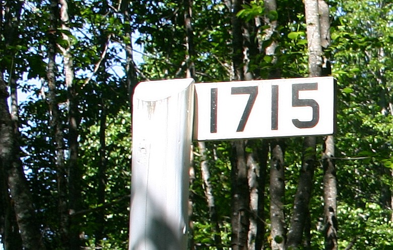
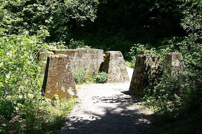
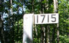
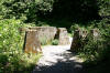
At Milepost 1715, near the former town site of Embro,
we passed yet another concrete retaining
wall and met the first group of people heading uphill.
Many of them were scowling and several asked, "Is there
anything interesting to see up ahead?"
I didn't have the heart to tell them about the scratchy brush
over the trail (they were ALL wearing shorts), but did tell them
the views from Windy Point were well worth the hike.
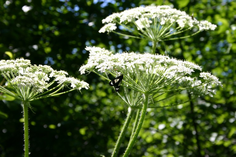
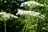
As we hiked along to MP 1716, I saw what they meant. There's
really nothing much to see on this stretch (except a little
butterfly) as the trail is straight-as-an-arrow through a
colonnade of trees. Just before the 1716 milepost is the
Martin Creek cross over which takes us down to the trailhead.
This is VERY steep and we passed another large group trudging
uphill. By now it was afternoon and getting very warm (80's)
even in the shade. Yep, walking downhill is the way to go.
On our way out, we checked the Martin Creek trail register.
Hey, whaddiya know. Bob and Pam Kelly had signed in yesterday
on July 1st! Just missed them....
We reached my truck at the Martin Creek trailhead without
further incident. I checked my clock...despite all our
dawdling along the way, we did the 6+ miles in under
3 hours, 30 minutes! Not bad.
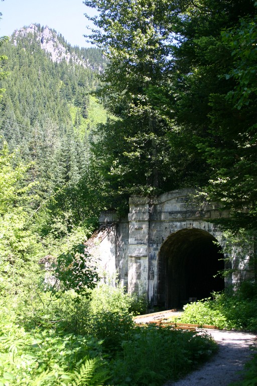
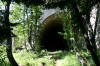
We piled in the truck and headed back for the Wellington
trailhead. We had one more thing to do, which was take
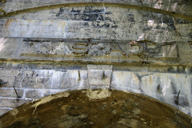
the short stroll up to the west portal of the old
Cascade Tunnel.
    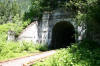
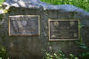
The foundation picture is of the water tower close to the
portal. There was also a concrete foundation for a coal
tower on this trail.
A fun day! Perfect, sunny weather and an enjoyable hike
in the boonies...with a Great Northern theme. My hat is
off to the volunteers who built this trail and maintain it.
They
have done a superb job building and interpreting the route.
THE END
CLICK
HERE as Baolu and I hike the entire trail in 2007.
  |